
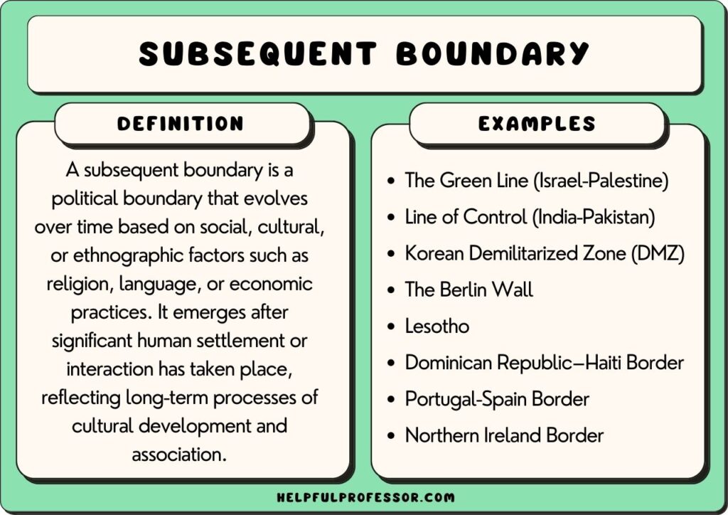
A subsequent boundary is a political boundary that was created after two groups have already settled there.
This type of boundary is often used to separate different groups of people based on their ethnicity or cultural background, and so it is often also called an ethnographic boundary. It’s often established to reduce tensions between two groups.
An example of a subsequent boundary is the border between Northern Ireland and the Republic of Ireland. This boundary was created to separate the majority protestant north and the majority Catholic south.
Subsequent Boundary Definition
In human geography studies, a subsequent boundary is a boundary established after the settlement of a region. The word ‘subsequent’ means after.
It is the opposite of an antecedent boundary, which was established prior to the settlement. The word ‘antecedent’ means before.
Subsequent boundaries are established as a result of both diplomatic agreement and conflict. How the boundary is established doesn’t affect the definition – rather, the only criteria is that a boundary is established after settlement has occurred.
A boundary can be both subsequent and other types of boundaries. For example, the Korean Demilitarized Zone (DMZ) is subsequent, consequent, demarcated, and militarized.
Subsequent Boundary Examples
1. The Green Line (Israel-Palestine)
The green line between Israel and Palestine was established in 1949 as a ceasefire line after the Arab-Israeli War.
The purpose of the green line was to serve as a temporary border until a more permanent solution could be reached. However, over the years the green line has come to be seen as the de facto border between Israel and Palestine.
The green line is not an internationally recognized border, and there is no passport control or customs between the two countries. However, the green line has a significant impact on the lives of Palestinian and Israeli citizens. Palestinians living on the Israeli side of the green line are subject to military law, while Israelis living on the Palestinian side are subject to civil law.
As a result, the green line has come to symbolize the divide between Israelis and Palestinians, also known as the two-state solution.
2. The Line of Control (India-Pakistan)
The line of control (LOC) is the de facto border between India and Pakistan.
The LOC was established in 1972 after the Simla Agreement between India and Pakistan. The Simla Agreement was a peace treaty signed after the Indo-Pakistani War of 1971.
The LOC is not an internationally recognized border, and there are no passport controls or customs between the two countries. However, the LOC is heavily militarized, and there have been many skirmishes and conflicts along the border.
People living on either side of the LOC are not allowed to cross without a special permit, and there are strict restrictions on trade and travel.
3. Korean Demilitarized Zone (DMZ)
The Korean Demilitarized Zone, or DMZ, is a 4-kilometer-wide strip of land that runs along the border between North and South Korea.
The DMZ was established at the end of the Korean War in 1953 as a way to create a buffer zone between the two countries. It separated the communist north and the capitalist south. Sadly, it separated many families and friends, as the border was a result of warring ideological groups rather than cultures.
Today, it is one of the most heavily fortified borders in the world, with barbed wire, concrete walls, and land mines dotting the landscape.
Despite its name, the DMZ is far from being a peaceful place. In fact, it is considered one of the most dangerous places on Earth, as tensions between North and South Korea remain high. If war were to break out again, the DMZ would likely be one of the first places to see fighting.
4. The Berlin Wall
The Berlin Wall was a physical barrier erected by the German Democratic Republic (GDR, East Germany) starting on 13 August 1961. It completely cut off capitalist West Berlin from communist East Germany.
The barrier included guard towers placed along large concrete walls, which circumscribed a wide area (later known as the “death strip”) that contained anti-vehicle trenches, “fakir beds” and other obstacles.
The Eastern Bloc claimed that the wall was erected to protect its population from fascist elements conspiring to prevent the “will of the people” in building a socialist state in East Germany.
In practice, the Wall served to prevent the massive emigration and defection that marked Germany and Berlin during the post-World War II period.
The Berlin Wall is an example of a subsequent boundary because it was established in the middle of a built-up city, well after the two groups – the capitalists and communists – were already there.
5. Lesotho
Lesotho is a small landlocked country located in Southern Africa. It is bordered by South Africa on all sides.
The borders of Lesotho were established in a series of wars and skirmishes throughout the 19th Century between a coalition of indigenous tribes led by King Moshoeshoe I and the Boer colonizers.
King Moshoeshoe and his warriors managed to maintain sovereignty over their land despite attempted settlements by the colonizers and, subsequently, signed a range of treaty agreements allowing them to establish an internationally recognized land border.
While the British eventually managed to rule Lesotho between 1869 and 1966, the borders of Lesotho were well-established, and in 1966, the nation managed to establish its independence once more. Today, Lesotho is a constitutional monarchy, with King Letsie III as its head of state.
6. Dominican Republic–Haiti Border
The Dominican Republic and Haiti are two countries located on the island of Hispaniola in the Caribbean Sea. The Dominican Republic is predominately Catholic, while Haiti is predominantly Protestant. Ethnically, the Dominican Republic is mostly made up of people of Spanish and African descent, while Haiti is mostly made up of people of African descent.
There have been a number of border disputes between the Dominican Republic and Haiti throughout history. One of the most notable disputes occurred in the late 19th century, when the two countries fought a series of wars over control of the border region known as the Cibao.
In 1934, the Dominican Republic and Haiti signed the Treaty of Saint-Germain-en-Laye which officially established their shared border. Prior to this, the boundary between the two countries was largely undefined.
Under the terms of the treaty, Haiti ceded approximately 158 square miles of territory to the Dominican Republic. This area includes the important border town of Ouanaminthe, as well as several surrounding villages. In exchange, the Dominican Republic agreed to pay Haiti $750,000.
The treaty also delineated the exact course of the border, which runs from the Caribbean Sea in the south to the northern tip of the island, where it meets the Atlantic Ocean.
7. Portugal-Spain Border (Battle of Ourique)
The boundary between Portugal and Spain was established to separate the Muslim caliphate in Spain and Catholic Portugal back in 1139. The border has been disputed at various times in the centuries since, but this was the origin of the soverign Portuguese state.
In the Battle of Ourique, the Portuguese forces led by Alfonso Henriques defeated the Moors to the east. This victory was significant as it marked the first time the Portuguese minority had been able to successfully resist Moorish attacks.
Prior to the battle, the Portuguese had been retreating from the Moors. However, Alfonso Henriques decided to make a stand and fight. The Portuguese were outnumbered and outmatched, but they were able to defeat the Moors and drive them out of Portugal.
This victory helped establish Portugal as a separate and independent country from Spain.
8. Northern Ireland Border
The border between Northern Ireland and the Republic of Ireland was established in 1920 to settle a dispute between the Catholic south and protestant north.
The 32 northern counties wanted to remain a part of the UK, while the Catholic south sought independence.
The border that was put in place partitioned the island of Ireland into two separate jurisdictions. Northern Ireland remained part of the United Kingdom, while the southern part of the island became an independent republic.
There have been periodic flare-ups of violence, most notably during the Troubles of the late 20th century.
Subsequent vs Consequent Boundaries
Subsequent boundaries and consequent boundaries are the two most similar types of boundaries studied in human geography. Usually, a subsequent boundary is also a consequent boundary.
Here are some similarities and differences:
- Subsequent boundaries are the opposite of antecedent boundaries. A subsequent boundary is established after people have settled somewhere. An antecedent is established before the new population settles there.
- Consequent boundaries are created as a consequence of a cultural, religious, ethnic, or political divide between two groups.
- Subsequent boundaries are created after groups have settled somewhere.
- Very often, a subsequent boundary (i.e. a boundary created after settlement) is put in place as a consequence of conflict on the gorund. As a result, subsequent boundaries are usually also consequent boundaries.
While these two concepts overlap significantly, keep your focus on the definitional difference: subsequent means “after” settlement, whereas consequent means “as a consequence” of a divide between two groups.
Other Types of Boundaries in Human Geography:
- 14 Types of Boundaries in Human Geography
- Superimposed Boundaries – Definition, Examples, Pictures
- Relic Boundaries – Definition, Examples, Pictures
- Geometric Boundaries – Definition, Examples, Pictures
Conclusion
Subsequent boundaries are political boundaries that are created after one or more groups have settled in a region. The term is usually used as a contrast to antecedent boundaries which are put in place before new groups settle or colonize an area. Examples of subsequent boundaries include the Portugal-Spain border and the Northern Ireland border.

Dr. Chris Drew is the founder of the Helpful Professor. He holds a PhD in education and has published over 20 articles in scholarly journals. He is the former editor of the Journal of Learning Development in Higher Education. [Image Descriptor: Photo of Chris]